DDK Forestry & Real Estate (DDK) uses custom embedded maps from Acres.com across their listings so buyers can analyze and interact with a property's boundaries, terrain, access, and land cover before a showing is even scheduled.
Whether someone's driving out to walk a property or just starting to compare options online, they're usually working through a similar handful of questions. An interactive map embed lets them answer each one on their own, right from the listing page.
4 Key Questions Land Buyers Should Analyze
Before zeroing in on property-specific goals, buyers can use embeds to answer four foundational questions:
"Where are the property’s boundaries?" Total acreage and boundary lines are often a buyer’s starting point. Clear parcel lines over satellite imagery lets buyers confirm the property's footprint, shape, road access, or water frontage.
"Can this land support what I'm planning?" Soil composition and land cover data tell buyers what the ground can realistically support, whether that's row crops, timber, grazing, or development, so buyers can rule out a property or commit to a site visit with confidence.
“What surrounds this land?” Embeds can reveal what's nearby, how developed the area is, and who else owns land around the property, since neighboring land use can shape a buyer's experience just as much as the property itself.
"What's the terrain like?" Elevation data, 3D viewing, and topography base maps highlight slopes, ridges, and low points, helping buyers judge drainage, buildability, and how usable the land might be across its full acreage.
By the time a buyer reaches out, they've already analyzed the basics themselves. They come in with specifics, and a real sense of whether the property aligns with their goals.
Broker Advice: What to Look For When Analyzing a Listing Map
Here's what DDK's agents recommend checking when reviewing a listing's embed:
“When analyzing a map embedded in a land listing, buyers should focus on the spatial context of a subject property. A well-designed map of a property for sale can answer many questions a buyer may have before they even pick up the phone. Elements such as elevation, access to utilities, and/or adjacent land use are all questions maps can answer quickly.” — Mark Knight, Partner & CEO, DDK Forestry & Real Estate
"Access is the first thing I check. Is it on a county road or highway?...You can have the best property in the area, but without access, you're stuck." — Doug Moore, Director, Business Development & Operations, DDK Forestry & Real Estate
When buyers can analyze access, boundaries, terrain, and suitability directly on an interactive map, they get a well-rounded initial assessment of a property's true capability. See how embeds surface property details across three active DDK listings below.
Explore 3 Listings Buyers Are Analyzing With Interactive Maps
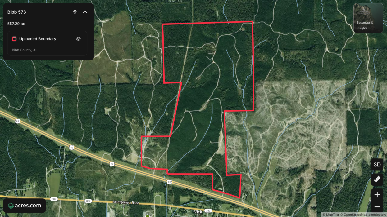
Hilltop Hunting Retreat - Centreville, Alabama
This 573±-acre tract in Bibb County works as a timber investment, a hunting retreat, or both. It features direct highway frontage and six well-established stands of planted pines, from a mature 1996 plantation, to a younger 2015 Pine plantation. Large food plots are spread throughout the property, making it a strong fit for wildlife management and recreational hunting as well.
At roughly $2,594 per acre, it offers a well-balanced mix of active timber management and immediate recreational use. View the full listing and interactive map embed on DDK's site.
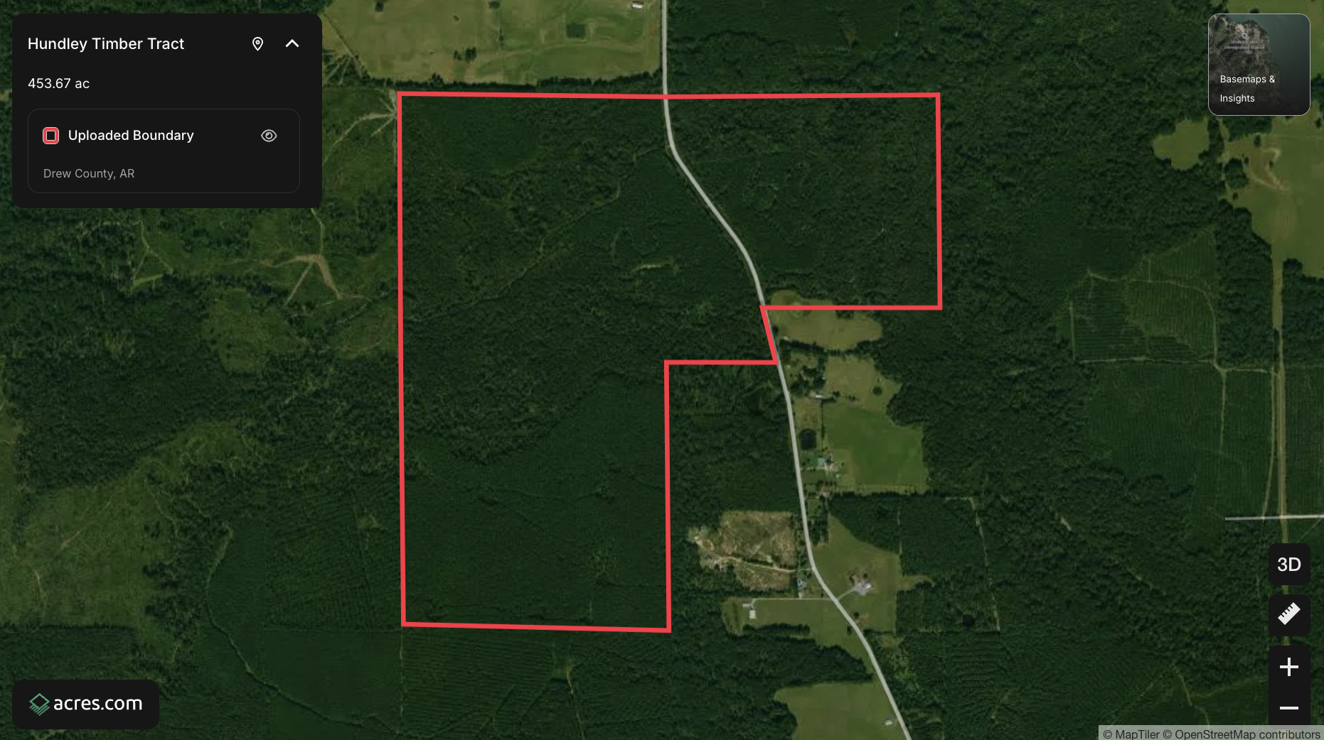
Highway 133 - Wilmar, Arkansas
This 454±-acre timber tract in Drew County combines over 100 acres of established pine plantation with wooded creek bottoms along Handly Creek. The bottomland hardwoods add fertile, productive ground to the property and create prime wildlife habitat, a draw for hunters and timber buyers alike. Frontage on both sides of Highway 133 and an internal road system make it easy to access and navigate.
At roughly $2,438 per acre, it pairs long-term timber investment with hunting and recreational potential in one property. View the full listing and interactive map embed on DDK's site.
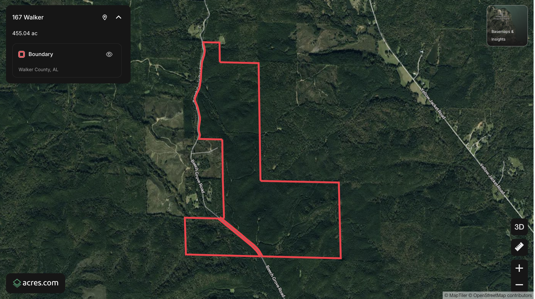
Walker County Sporting Tract - Townley, Alabama
This 463± acre property just south of Carbon Hill features 340 acres of 2004 pine plantation ready for its first thin, along with bottomland hardwood, established food plots, and hunting history. Centrally located near Birmingham, Huntsville, and Tuscaloosa, it's a prime option for timber buyers, hunters, and investors alike.
At roughly $2,001 per acre, it combines an established timber asset with a proven hunting track record in one property. View the full listing and interactive map embed on DDK's site.
How Buyers and Brokers Can Leverage Map Embeds to Save Time and Improve the Listing Experience
Map embeds change the impact of a listing. With Acres’ interactive embeds, buyers can explore a property, compare terrain, and evaluate fit before they commit.
“Because a simple property address or pin does not convey enough detail for land, we redirect them to our websites, which have detailed maps attached to the properties for sale. This usually gives them the context they are looking for in order to pursue the property further.” — Knight
The value runs for both parties: Buyers already have a real feel for the property and walk into conversations with informed questions, while brokers get to spend their time on showings that are a stronger match from the start.
For DDK, it's also changing how listings get marketed. An embed gives buyers extra context on a listing page, allows them to arrive with real questions, and move faster once they're ready.
Explore DDK's current listings to see Acres map embeds in action!