Land acquisition teams know the friction of using dozens of tabs, subscriptions, and data sources just to evaluate a single property. In a recent webinar, Acres’ Chief Strategy Officer Ben Maddox and Senior Product Manager Amanda Banks introduced six new datasets designed to consolidate research, validate sites faster, and move from analysis to owner outreach all within Acres.
Here are the biggest takeaways from the session.
1. Skip Tracing: Move From Search to Outreach in Minutes (3:30)
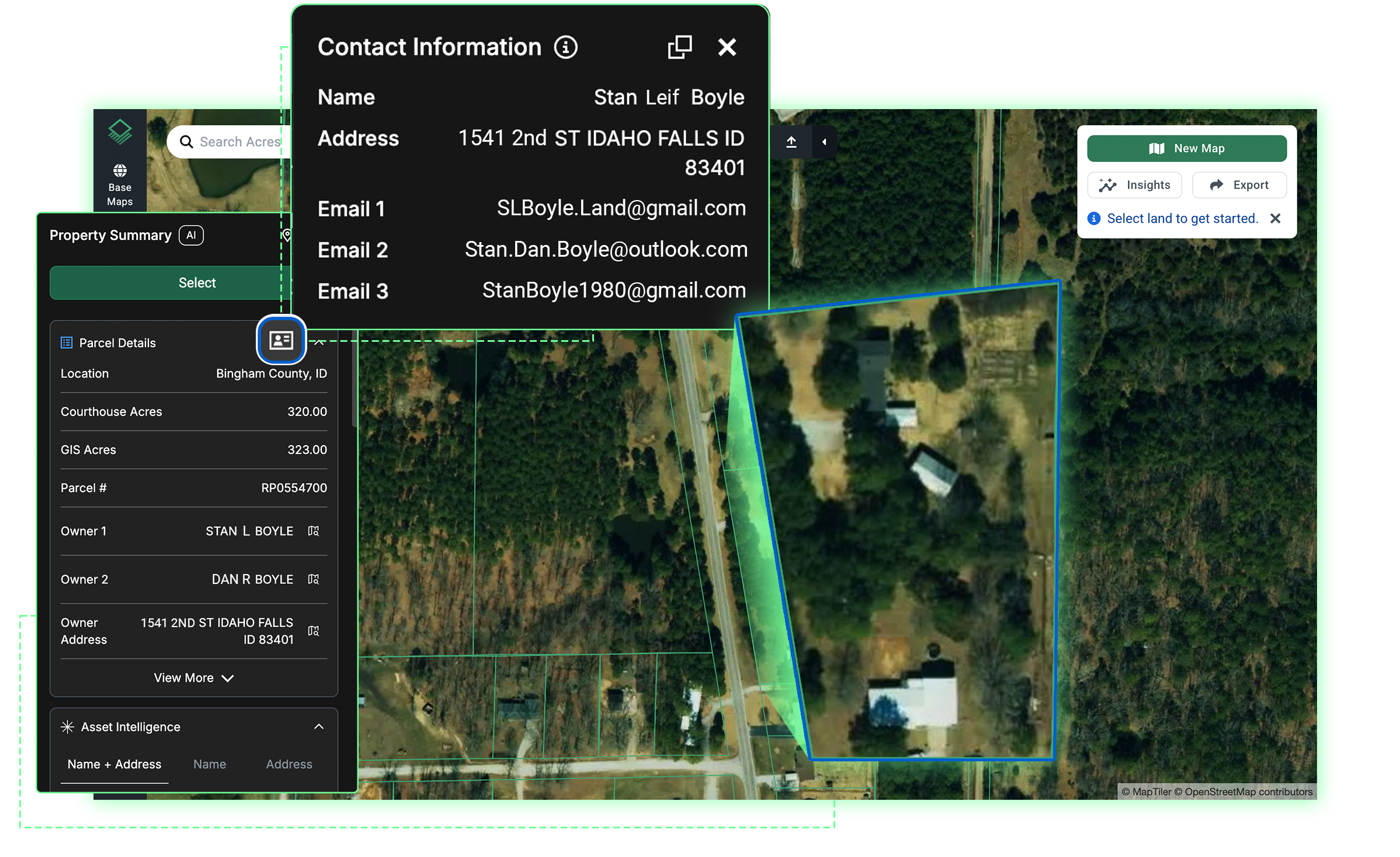
“Acres already provides the ability to build a targeted direct mail list inside the application that allows you to send mail directly to land owners throughout the United States. But now we also provide phone numbers and email addresses for parcel owners across the U.S. as well.”
“In Acres, you can actually search for land that meets your exact criteria and instantly contact the owner.”
Takeaway: Land acquisition teams often rely on separate tools to obtain owner contact information after identifying a target property. With phone numbers and email addresses now integrated directly into Acres, teams can search for land that meets their criteria and immediately access owner contact details within the same workflow.
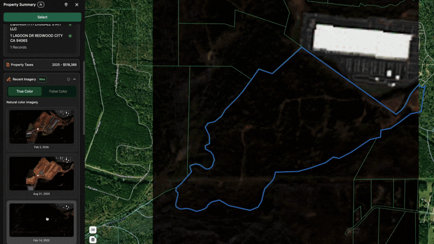
2. Weekly Satellite Imagery: Monitor Development Activity (4:30)
“How much time do you think you probably spend inspecting and monitoring new developments in person? You can now track those developments from your office every single week using Acres. Horizontal and vertical developments can all be easily tracked with our weekly imagery feature.”
Takeaway: Monitoring competitor projects or nearby development activity typically requires site visits or reliance on outdated imagery. Acres now provides weekly satellite imagery, allowing teams to track grading, vertical construction, and infrastructure progress from their desks. This consistent visibility helps acquisition teams validate market momentum and adjust strategy without field travel.
3. Street View: Validate Property Conditions in Seconds (5:40)
“Easily track project progress from the ground…Our clients are using this to evaluate properties, examine access issues for properties, and even look at project development progress.”
Takeaway: Early-stage site validation often hinges on details like access, frontage, surrounding land use, and physical barriers. Street view is now accessible directly within Acres, giving teams ground-level visibility alongside aerial imagery on the same interface. By confirming site conditions in seconds, acquisition teams can filter properties more efficiently before committing time to in-person visits.
4. Traffic Data: Identify High-Growth Corridors (6:33)
“Acres now provides national daily traffic volumes all in one simple dashboard. So our clients are using this data to identify growth corridors, potential bottlenecks, and maybe even overlooked assets that are in a great spot that no one has picked up yet.”
Takeaway: Traffic data is a foundational input for site selection but is often fragmented across state and municipal transportation agencies. With this dataset integrated into Acres, teams can instantly overlay corridor strength onto their land search. This enables faster identification of growth corridors and more confident prioritization of sites based on sustained traffic demand.
5. Building Permits: Spot Development Activity Early (7:20)
“This data…allows you to search by permit type, [and] view the permit owner as well.”
Takeaway: Building permit records provide one of the clearest signals of forward-looking market activity, yet they are typically dispersed across jurisdictions. Permit data inside Acres allows teams to search by permit type, view permit owners, and understand who is actively building in a given submarket. That visibility helps acquisition teams validate growth trends and prioritize sites in areas with development momentum.
6. Land Use Sentiment: Gauge Local Support Before You Invest (8:18)
“The sentiment data layer inside of Acres now provides numerical ratings that show you local support or opposition to rezoning applications and data center developments. This allows you to avoid wasted time and sunk costs by researching local development sentiment before you buy a property.”
Takeaway: Community opposition and zoning resistance can introduce risk late in the acquisition process. Through Acres’ partnership with Hamlet, the platform provides sentiment data across more than 3,000 city and county governments, offering insight into local support or opposition. By incorporating local approval dynamics into early screening, teams can reduce risk and focus on markets with clearer approval pathways.
Final Thoughts
When traffic and permit data, ground-level street view, sentiment, and owner contact information live in one workflow, prioritization becomes clearer and outreach happens sooner. For acquisition teams, the ability to identify, validate, and move to owner outreach faster separates early movers from the rest of the market.
See how a unified workflow can accelerate your acquisition process. Book a demo to see these datasets in action.