GIS & Mapping
Map Highlight: Miami, FL Zoning Map
Explore Miami’s zoning map and learn how the Miami 21 code shapes sustainable, mixed-use development. Access parcel-level zoning data with Acres.
Explore the interactive Chicago zoning map on Acres. Access accurate, parcel-level zoning data for smarter land investment, planning, and development.

Zoning laws shape everything from property values to project viability, which is why accurate, accessible zoning data is critical for anyone working in land, development, or investment.
With interactive overlays, parcel-level insights, and data pulled directly from the City of Chicago, Acres helps you evaluate zoning alongside thousands of other data layers so you can move faster and spot opportunities others miss.
Acres.com provides an interactive Chicago, IL Zoning Map via Acres' Layers. This powerful tool enables you to quickly view zoning map overlays and classifications for individual properties.
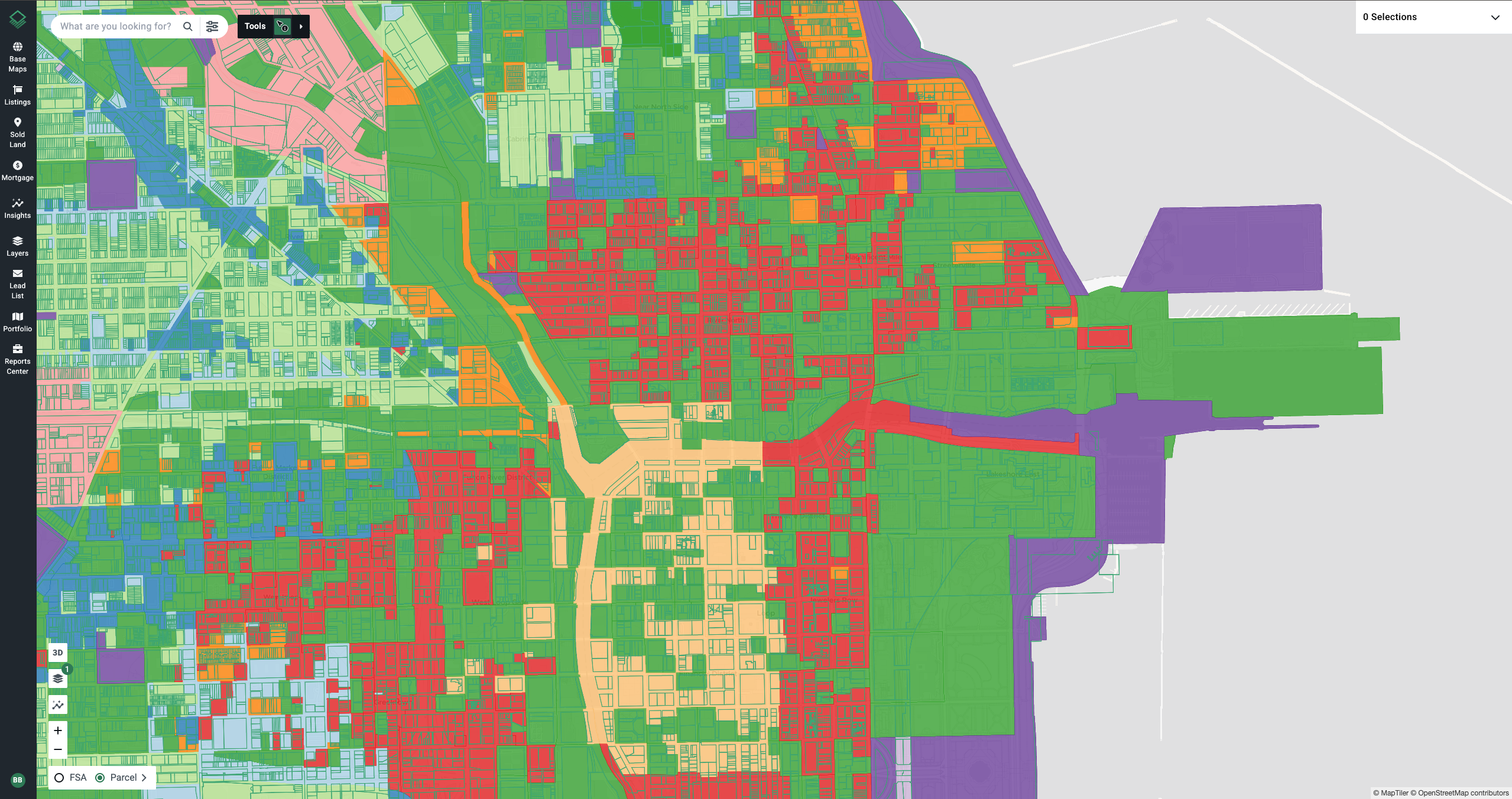
Acres’ Chicago, IL zoning data is derived from the City of Chicago.
From residential neighborhoods to downtown commercial corridors, each zoning category plays a vital role in shaping the city's built environment, promoting compatible land uses, and guiding future growth.
Start exploring the city of Chicago zoning map and thousands of other data layers today.

Explore Miami’s zoning map and learn how the Miami 21 code shapes sustainable, mixed-use development. Access parcel-level zoning data with Acres.
Discover zoning codes and overlays with Acres’ Columbus Ohio zoning map. Get parcel-level insights and evaluate land potential with confidence.
Explore the Orange County zoning map to view detailed parcel-level zoning data. Instantly access Orange County planning and zoning overlays to...
