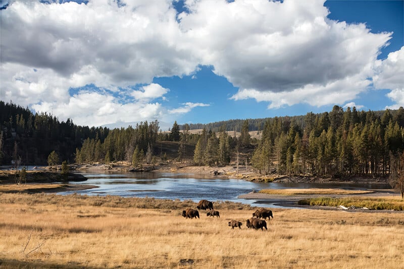
With 650 million acres under its care, the U.S. federal government is the nation’s largest landowner. These public lands fuel conservation efforts, outdoor adventure, and resource management, playing a vital role in America’s landscape and legacy.
Map of U.S. National Lands
Acres.com offers a free, interactive Public Lands Map, a comprehensive visualization of national and regional public lands across the country. Available in our Layer Library, this tool highlights federal, state, and local lands designated for:
- Natural and Historical Conservation
- Recreation
- Cultural Preservation
- Natural Resource management
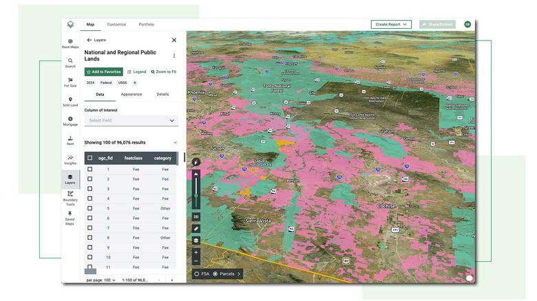
Acres’ National and Regional Public Lands Map is derived from data provided by the U.S. Geological Survey's Gap Analysis Project (GAP).
Types of Public Lands
U.S. public lands fall into two categories—national and regional—each managed by different government agencies.
95% of public lands are managed by four major agencies—the Department of Agriculture’s Forest Service (FS), the Bureau of Land Management (BLM), Fish and Wildlife Service (FWS), and National Park Service (NPS).
National Public Lands
Owned by the federal government, these lands serve purposes such as conservation, recreation, and public use.
- National Parks & Forests: Protected for scenic beauty, biodiversity, recreation, and habitat conservation.
- National Wildlife Refuges: Managed for wildlife protection and conservation.
- Bureau of Land Management (BLM) Lands: Used for conservation, livestock grazing, recreation, and renewable energy.
- National Monuments: Preserve significant natural, cultural, or historical sites.
Regional Public Lands
Managed by state and local governments, these lands are designed for community recreation and conservation.
- State Parks & Forests: Provide recreational activities while preserving natural habitats.
- City & County Parks: Offer public access to green spaces for outdoor activities.
How Public Lands Affect Property Owners & Buyers
Proximity to public lands can potentially impact property value, development potential, and land use. By understanding these benefits and challenges, property owners, investors, and businesses can make informed decisions about living or operating near public lands.
Potential Benefits
- Property Value: Properties adjacent to National Parks or Forests can see an increase in value due to scenic views and recreational opportunities. This can be a major advantage for homeowners looking to sell or investors seeking long-term appreciation.
- Preserving Open Spaces: Limited development protections help prevent urban sprawl, maintaining the area's natural beauty, reducing congestion, and ensuring a higher quality of life for residents.
- Economic Growth & Business Opportunities: Public lands attract visitors, boosting local businesses like lodges, restaurants, and recreation services. This creates jobs and provides entrepreneurs with a steady tourism-driven customer base.
Potential Drawbacks
- Development Restrictions: While conservation efforts may cause stricter zoning and land-use regulations that limit private property expansion. This can impact property owners looking to build or modify land use.
- Public Access: Easements and trails that run near or through private property may lead to privacy concerns. Property owners may have to contend with increased foot traffic or ensure compliance with access regulations.
- Noise & Congestion: Popular public lands can bring seasonal surges of visitors, leading to congestion, noise, and pollution. While this can boost local businesses, it may also disrupt the peace and quiet that many homeowners seek in these areas.
Final Thoughts
Acres' Public Lands Map is a free, interactive tool that helps landowners, buyers, and industry professionals visualize and understand public land boundaries and management.
By providing detailed GIS-powered insights, this tool allows users to make informed decisions about land use, investment opportunities, and conservation efforts.