In March 2025, the Department of Government Efficiency (DOGE) announced a bold move: to dispose of hundreds of government-owned properties it identified as "non-core to government operations." The initial list included over 400 buildings. But by March 21, the General Services Administration (GSA) narrowed that list to just eight.
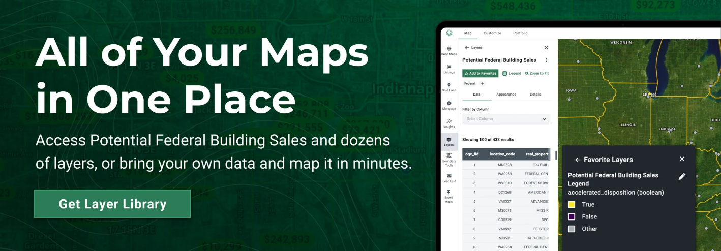
To help land professionals explore these shifts, Acres.com offers a free, interactive Potential Federal Building Sales Map. This tool visualizes properties from the original 400+ list, allowing users to quickly identify federal real estate trends across the country.
Connect with our sales team today to explore hundreds of data layers!
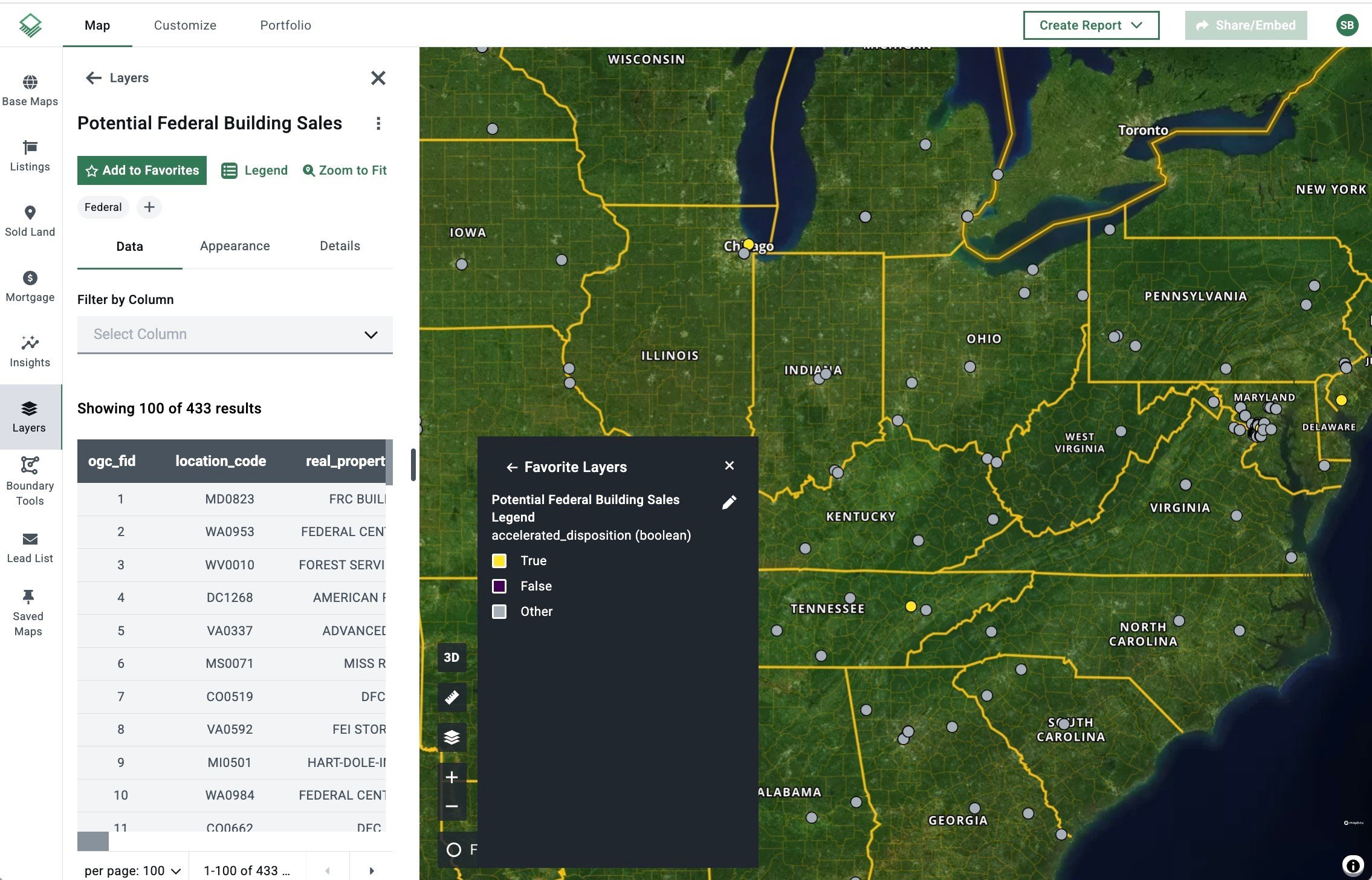
Acres’ potential federal building sales data is derived from the US General Services Administration (GSA).
Why is DOGE Selling These Buildings?
- Reduce Taxpayer Costs: Unused properties still incur expenses—utilities, maintenance, security. Selling them helps allocate taxpayer funds more efficiently.
- Address Underutilized Space: Post-pandemic workplace changes mean many agencies no longer need large physical footprints. Downsizing helps optimize usage.
- Rebalance the Federal Footprint: This initiative aligns with the President’s Management Agenda, aiming to consolidate operations into higher-performing facilities.
- Eliminate Costly Maintenance: The GSA estimates this move could save over $430 million annually by avoiding capital costs on outdated structures.
- Modernize Infrastructure: Many buildings no longer meet today’s needs. Selling them opens the door to reinvestment in energy-efficient, flexible spaces.
Using Acres’ Layer Library to Get Ahead
Spot Opportunities Early
DOGE’s asset disposition process often identifies surplus federal properties—some of which may be underutilized or mispriced relative to market value. By mapping these opportunities, Acres users can visualize prime acquisition targets before they’re widely known.
Streamline Due Diligence
Instead of combing through spreadsheets or disconnected data sources, users can view property details, locations, and surrounding land attributes all in one intuitive interface.
Plan Strategically in Emerging Markets
As federal properties become available, they can signal shifting government priorities. A map-based view helps users track these patterns and act early in emerging hot spots.
Overlay Critical Data Layers
With Acres, users can overlay federal property listings with zoning, land use, flood zones, comps, and market activity. This contextual insight turns raw data into actionable intelligence.
Share and Collaborate with Stakeholders
Custom, shareable maps make it easy to communicate opportunities with clients, team members, or partners. Users can highlight potential sites and generate professional reports with just a few clicks.
Real-Time Market Intelligence
Acres updates its sales data and mapping layers in real-time. When federal assets hit the market, users are among the first to know—keeping them ahead of the competition.
Final Thoughts
As federal agencies streamline their real estate holdings, opportunities are emerging for developers and investors alike. With Acres’ Potential Federal Building Sales Map, you can identify prime locations, layer in critical data, and stay one step ahead of the market.
Explore the map now at Acres.com and discover your next investment opportunity.