GIS & Mapping
Map Highlight: U.S. Battery Storage Plants Map
Track battery storage plant locations nationwide and understand their impact on land value with Acres.com’s powerful mapping tools.
Identify key renewable diesel and biofuel production facility locations across the US with Acres.

The Renewable Diesel & Biofuels map from Acres.com equips you with land data you can act on. Locate operational facilities, assess feedstock proximity, and understand how clean energy is reshaping rural America.
Biofuels are renewable fuels derived from biomass and various feedstocks such as soybeans, corn, algae, and animal fats. Unlike traditional fossil fuels, biofuels offer a more sustainable energy solution, potentially reducing greenhouse gas emissions while promoting energy diversification.
Available in our Layer Library, the Renewable Diesel and Biofuels map offers key insights across the U.S. This interactive layer includes:
To explore this map and hundreds of other layers, connect with our sales team today!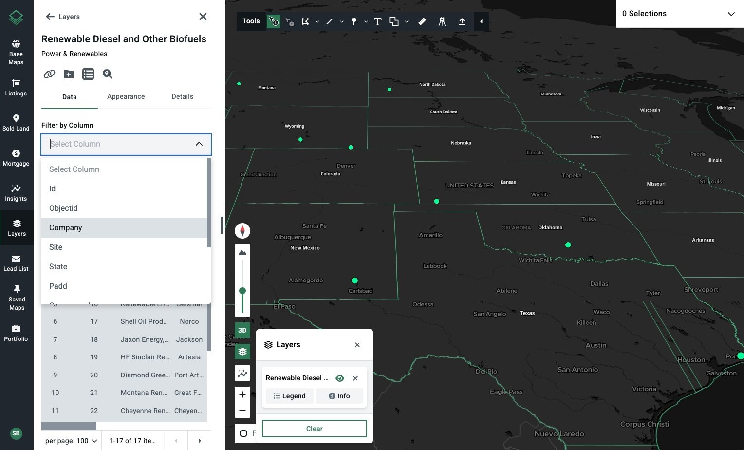
Acres’ nationwide biofuel data is derived from the Energy Information Administration (EIA).
With policy incentives accelerating investment and the private sector racing to decarbonize, we're seeing distinct regional clusters emerge as growth hubs for renewable diesel and other biofuels. The Acres Renewable Diesel & Biofuels map lets you spot these high-velocity zones at a glance—and evaluate the factors driving them.
Gulf Coast (PADD 3): Leading the nation with 2.2 billion gallons of capacity across 8 plants, the Gulf Coast benefits from infrastructure advantages—ports, refineries, and feedstock processing clusters.
West Coast (PADD 5): California and Washington host a combined 1.2 billion gallons in capacity—driven by state incentives like the Low Carbon Fuel Standard (LCFS), and demand for Sustainable Aviation Fuel (SAF).
Midwest (PADD 2): Minnesota, North Dakota, and neighboring states form the feedstock heartland. With abundant corn and soy, they’re ideally positioned to supply low-carbon biorefineries.
These growth clusters aren’t just dots on a map—they’re signals. Whether you’re scouting for industrial land near future biorefinery zones or assessing farmland that could shift in value due to feedstock demand, this layer helps you move ahead of market momentum.
Use it alongside Acres’ zoning, soil, and transaction history layers to identify high-potential parcels faster.
With the Acres Renewable Diesel and Biofuels map, land professionals can quickly identify strategic facility locations and assess estimated production capacity at each site. Make decisions faster with precise, actionable insights right at your fingertips.

Track battery storage plant locations nationwide and understand their impact on land value with Acres.com’s powerful mapping tools.
Explore Acres’ national biodiesel plants map to evaluate proximity to production facilities, land use trends, and investment potential.
Explore U.S. ethanol plants with Acres’ map. Learn how these facilities can influence land values, crop prices, and development.
