Why Environmental Risk Analysis Matters
In an era of increasing environmental uncertainties, accurate risk assessment is essential for homeowners, builders, and developers. Acres.com's Layers offer a powerful solution by integrating geospatial datasets, performing advanced spatial analyses, and generating actionable insights.
From evaluating flood susceptibility and monitoring deforestation to assessing soil degradation, Acres simplifies complex data workflows, empowering researchers, policymakers, and businesses to make informed, data-driven decisions.
This case study explores how Acres enhances environmental risk assessments, demonstrating its effectiveness in real-world applications.
How Acres Enhances Environmental Risk Assessments
Comprehensive Disaster Data
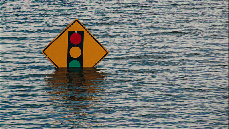
Using FEMA records, Acres visualizes various environmental risks across the country. Depending on the area of interest, users can access historical trend data on:
- Tornadoes
- Earthquakes
- Hurricanes
- Flood zones
- Drought-prone regions
This information helps prospective buyers and developers understand location-based risk factors before making investment decisions.
Wildfire Risk Analysis
Acres' environmental layers also provide insights into:
- Areas previously damaged by wildfires
- High-risk zones where future wildfires are likely
By overlaying fire history data with climate and vegetation patterns, Acres helps users assess fire-prone areas and develop mitigation strategies.
Why Is Environmental Risk Assessment Important?
For Property Owners
1. Financial Protection
Natural disasters such as floods, wildfires, and hurricanes can lead to costly repairs and long recovery periods. Understanding these risks helps property owners make informed choices to protect their investments.
2. Health and Safety
Environmental factors can directly impact health. For example:
- Excessive moisture → mold growth → respiratory issues (asthma, eczema)
- High air pollution levels → long-term health concerns
Choosing a home in a low-risk environment can help reduce health-related expenses and improve quality of life.
3. Property Value & Resale Potential
Even if a property’s location seems ideal, its susceptibility to natural disasters may deter potential buyers. Understanding risk factors allows owners to plan for long-term value retention.
4. Insurance Costs & Coverage
Properties in high-risk zones often have higher insurance premiums or limited coverage options. Evaluating environmental risks upfront helps homeowners anticipate costs and secure appropriate coverage.
For Property Developers
1. Avoiding Financial Setbacks
Environmental risks can lead to unexpected project delays, rising construction costs, or even total project losses. Proper assessment helps mitigate financial uncertainty.
2. Health & Safety Considerations
Extreme weather conditions, such as heat waves or severe winter storms, can pose risks to construction crews. Understanding local climate trends allows developers to plan safer working conditions.
3. Market Demand & Property Value
Properties in high-risk areas may struggle to attract buyers or tenants. Conducting a thorough environmental assessment helps developers ensure their projects remain profitable and marketable.
4. Reducing Legal Liabilities
If a natural disaster delays or halts construction, developers may face legal disputes from buyers or investors. Proactive risk assessment helps mitigate potential liabilities.
Conclusion
Acres Layers simplify environmental risk analysis, providing critical insights for homeowners, investors, and developers. By leveraging current geospatial data, users can make informed, confident decisions—minimizing risk and maximizing investment success.
Ready to assess environmental risks on your next parcel? Book a demo to see how Acres Layers provide the data-driven tools you need to navigate environmental uncertainties with confidence.