Building a local land data set with Acres.com's Layers gives your team a single, consolidated view of zoning, infrastructure, environmental, and demographic data nationwide. This case study walks through how to use Acres' Layers in four steps—using San Antonio, Texas as an example.
Step 1: Navigate to the Acres Layer Library
To begin, open the Layers tab and enter your desired location in the search bar. Ensure that you have selected the “All Layers” tab to view all available data for that area.
For this case study, we will use San Antonio in Bexar County, Texas, as an example. By entering this location, you can access a variety of public and private data layers that provide insight into zoning regulations, infrastructure, environmental factors, and more.
.png?width=1600&height=800&name=unnamed%20(10).png)
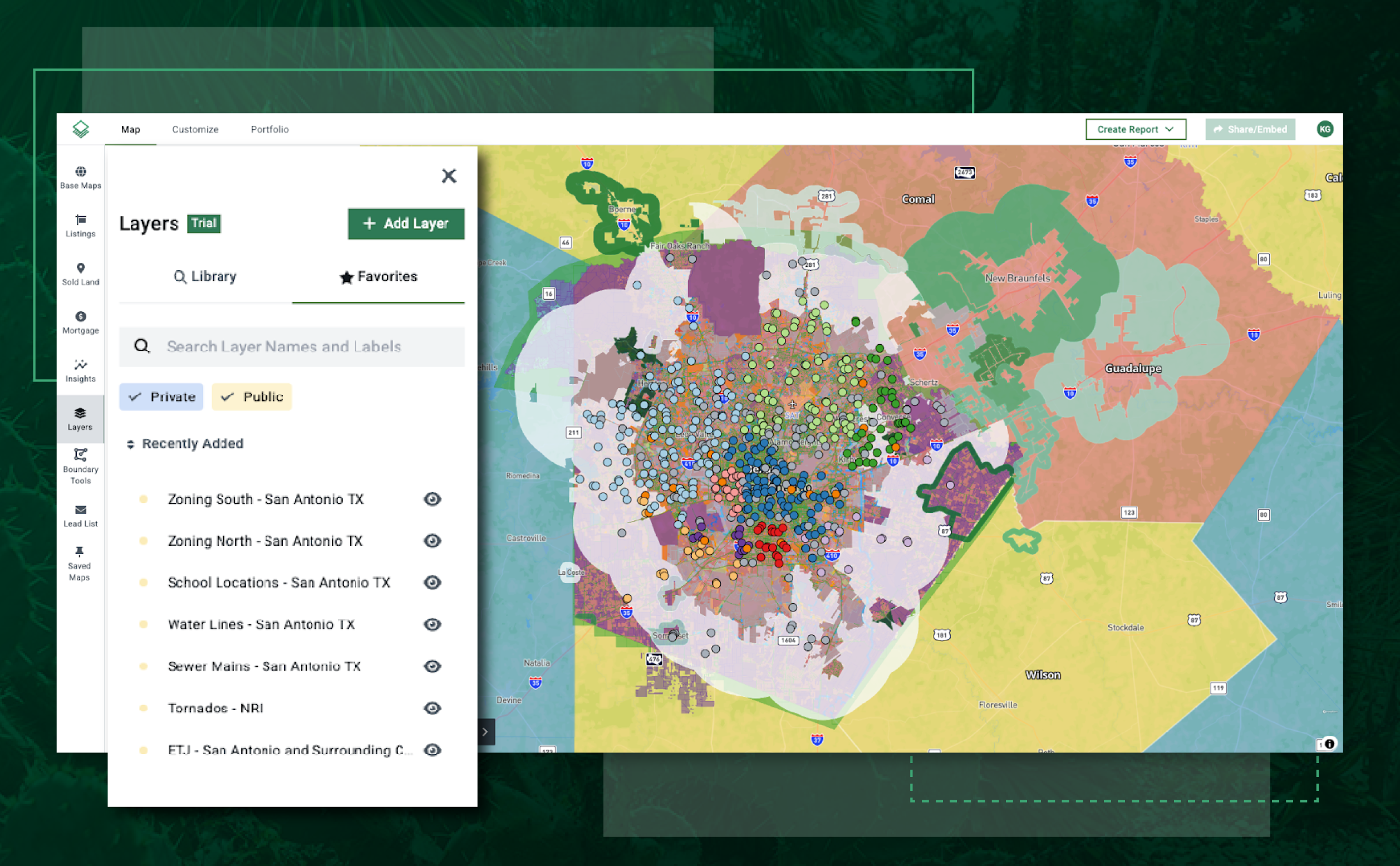
Step 2: Select and Organize Relevant Layers
Each available layer in the Layer Library has a star icon to the right. Clicking this star adds the layer to your favorites, allowing you to quickly access the most relevant information for your project.
Once you have selected all applicable layers, navigate to the “Favorites” tab. This section consolidates your saved layers, making it easier to switch between different data points without searching for them again.
.webp?width=760&height=377&name=unnamed%20(12).webp)
Step 3: View and Stack Layers for a Comprehensive Analysis
Each favorited layer has an eye icon that enables you to toggle its visibility on the map. Viewing layers individually allows you to analyze specific data points, while stacking multiple layers provides a broader perspective on the area.
For example, by layering zoning regulations, school locations, and infrastructure maps, a developer can assess how a property aligns with local regulations, its proximity to key amenities, and whether it has access to necessary utilities.
In addition to Acres’ database of preloaded layers, users can also upload their own custom layers through the “Add Layer” function. This is particularly useful for teams that rely on proprietary datasets or need to incorporate specialized geographic information into their workflow.
.webp?width=760&height=378&name=unnamed%20(11).webp)
Step 4: Utilize Key Layers to Inform Decision-Making
The Layers include a wide range of data sources that help teams make informed land investment and development decisions. Below are some of the most impactful layers available:
Zoning Layer
Zoning regulations dictate what types of development are permitted in a given area. This layer provides essential information for investors, developers, and planners who need to ensure that their intended land use aligns with local ordinances. By selecting a parcel within the zoning layer, users can access zoning classifications, permitted land uses, and any restrictions that may apply.
For example, a commercial developer evaluating a site for a retail center can quickly determine whether the area is zoned for commercial use, residential development, or mixed-use projects.
.webp?width=760&height=381&name=unnamed%20(13).webp)
School Location Layer
This layer highlights school districts with distinct colors and places markers at the exact locations of schools within a given area.
For housing developers, understanding school proximity is critical when targeting family-friendly communities. Properties located near highly rated schools often experience increased demand and higher property values. By overlaying school district boundaries with zoning and demographic data, developers can strategically plan new residential communities in high-growth areas.
.webp?width=760&height=379&name=unnamed%20(14).webp)
Water Line and Sewer Main Layers
Access to infrastructure is one of the most important considerations for land development. The Water Line and Sewer Main layers provide a detailed view of existing utility networks, helping developers determine whether a parcel has adequate access to water and wastewater systems.
For example, a builder planning a new subdivision needs to confirm that municipal water and sewer connections are available. If not, the project may require additional permitting, infrastructure investment, or alternative solutions such as well water and septic systems.
.webp?width=760&height=378&name=unnamed%20(16).webp)
.png?width=1600&height=758&name=unnamed%20(15).png)
Environmental and Hazard Layers
Environmental factors play a crucial role in site selection, particularly for developers working in areas prone to natural disasters or ecological concerns.
The Tornado Layer, for example, maps historical tornado activity and risk zones, allowing teams to assess the likelihood of severe weather events impacting a potential development site. By incorporating environmental layers into the site selection process, investors can better understand risks and mitigate potential challenges before committing to a project.
Additional environmental layers may include floodplain data, wetland designations, and wildfire risk assessments, all of which can influence land use decisions and development feasibility.
.png?width=1600&height=797&name=unnamed%20(17).png)
Final Thoughts
Acres is a platform for professionals seeking comprehensive land data. Whether you are a real estate developer, investor, or land planner, leveraging spatial data allows you to make more informed decisions and streamline project planning.
By using layers such as zoning regulations, infrastructure maps, school locations, and environmental risk assessments, teams can quickly build a customized dataset that supports their strategic goals.
For those looking to enhance their market insights and improve decision-making, Acres' Layers offer an intuitive and data-rich solution.