For energy developers, the difference between a high-ROI project and a write-off can come down to a single missed constraint: a hidden easement, a zoning overlay, or a substation with zero headroom.
Yet many energy developers are still making siting decisions with incomplete information, stitched together from disconnected parcel records, infrastructure maps, and local zoning codes. The result is slower timelines, missed opportunities, and costly surprises late in the acquisition process.
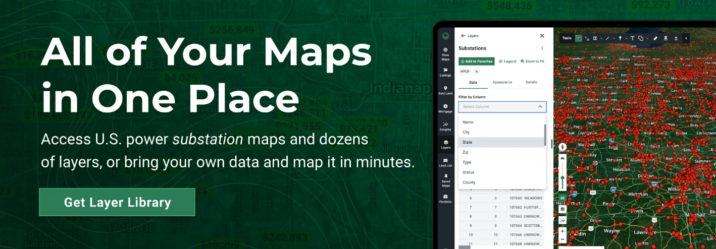
Acres.com brings parcel, infrastructure, and zoning data together in one place so energy teams can identify feasible sites faster and make lower-risk project siting decisions from the start.
Siting Risks in Energy Development
1. Inefficient Access to Power and Energy Infrastructure Data
For energy projects, infrastructure availability is often the primary factor in site feasibility. For data center developers, finding a site near a substation is useless if fiber redundancy is missing. For solar developers, transmission proximity means nothing if the queue is gridlocked.
Teams may find themselves calling individual districts, navigating disconnected municipal GIS portals, or piecing together research just to determine where water resources, easements, or transmission corridors are located. This manual approach slows early-stage screening and introduces risk.
Even when infrastructure is visible, capacity uncertainty remains a major obstacle. Knowing that a substation exists is not the same as understanding available headroom. Similarly, identifying fiber routes does not guarantee sufficient density or redundancy. These unknowns often surface late, after time and capital have already been committed.
How Acres helps:
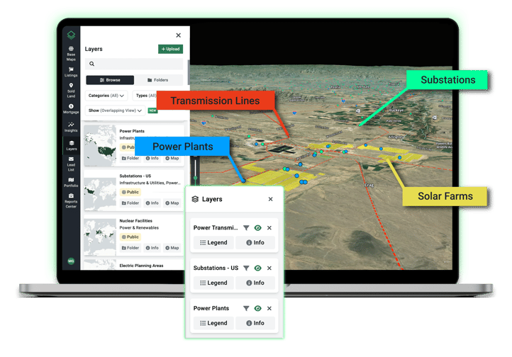
Acres brings infrastructure context into early-stage site selection by revealing parcels with transmission lines, substations, water districts, and other critical assets. Energy teams can filter for capacity and headroom—such as 345kV+ transmission lines or major substations—to screen sites faster, eliminate non-viable areas earlier, and reduce interconnection risk—without relying on fragmented data sources or site visits.
2. Zoning and Land Use Risk
Zoning incompatibility is one of the most common causes of project friction in energy development. Teams may identify promising parcels based on size, price, and infrastructure access, only to discover that zoning restrictions or local land use rules significantly limit or prohibit energy development.
By the time these issues surface, capital may already be committed. This risk is amplified by the fragmentation of local codes. Because ordinances vary across jurisdictions and are difficult to map to specific parcels, teams struggle to validate sites early.
Without early zoning clarity, teams can spend weeks worth of wasted time and commitments that introduce unnecessary risk.
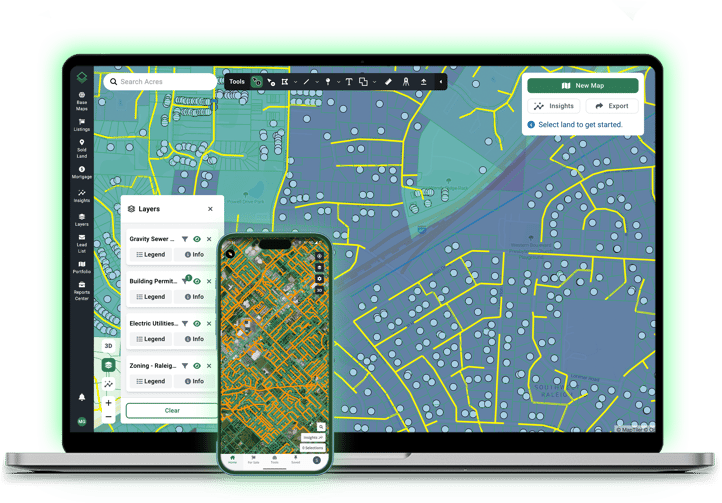
How Acres helps: Acres ties zoning and land use information directly to parcel data, allowing energy teams to assess whether a site aligns with project requirements before committing capital—so you can focus on viable sites and instantly disqualify ones that don't meet land use requirements, saving engineering resources for locations with true potential.
3. Regulatory Data Management Complexity
Even well-located, properly zoned sites can be undermined by legal and regulatory complexity that are difficult to identify early.
For energy projects, validating easements, access rights, and property boundaries can require surveyors, outside counsel, and complex records. As a result, issues that impact feasibility such as access limitations or encumbrances, may not surface until weeks into evaluation, after time and capital have already been invested.
This delayed visibility introduces avoidable risk and slows execution at a stage when speed and certainty are critical.
How Acres helps: Acres brings regulatory and parcel constraints into early-stage site selection by translating complex records into an intuitive, map-based platform. Energy teams can quickly understand boundaries, access, easements, flood risk, and constraints alongside infrastructure and zoning in one view. You can use Acres’ 4,000+ data layers or upload your own data and map out what you need instantly.
Lower-Risk Siting with Connected Land Intelligence
The commonality across these challenges is not a lack of data, but a lack of complete, connected intelligence. When parcel risks, infrastructure proximity, and zoning constraints are evaluated together, energy teams can:
- Screen sites more quickly and confidently.
- Focus engineering and interconnection efforts on truly viable locations.
- Improve valuation accuracy for infrastructure-ready land.
- Reduce late-stage surprises that delay or derail projects.
Smarter siting starts with better land intelligence—and lower-risk energy projects start with Acres.com. Connect with our team to see how energy developers can move faster, focus capital on viable sites, and reduce downstream risk with Acres.