Buy Land
An Introduction to Timberland Investment
Explore expert insights and benefits of timberland investment, including historical returns, income sources, and portfolio diversification.
Discover how Acres portfolio functions as the modern land portfolio utilities need to centralize assets, ensure compliance, and stay audit-ready.
.webp)
Utility companies manage vast networks of land assets—each tied to critical data that impacts daily operations, compliance, and long-term planning. Every piece of land may carry unique regulatory, environmental, or operational risks that demand accurate, up‑to‑date information. When data lives in disconnected spreadsheets or siloed department systems, governance gaps, inefficiencies, and compliance risks quickly emerge.
By delivering a centralized, shared workspace for all your land data, Acres.com gives utilities the control, visibility, and collaborative tools needed to manage land as a strategic asset.
With traditional land data management, each department often maintains its own records. That leads to fragmentation: property boundaries, ownership records, easement terms, environmental risk data, and infrastructure overlays may all be stored in separate systems or even on paper.
Without a unified system, it becomes difficult to maintain consistent records, trace decisions, or get a holistic view of land holdings across the enterprise. Even basic tasks, like verifying ownership or checking easement rights, can stall projects or trigger compliance failures when systems don’t communicate.
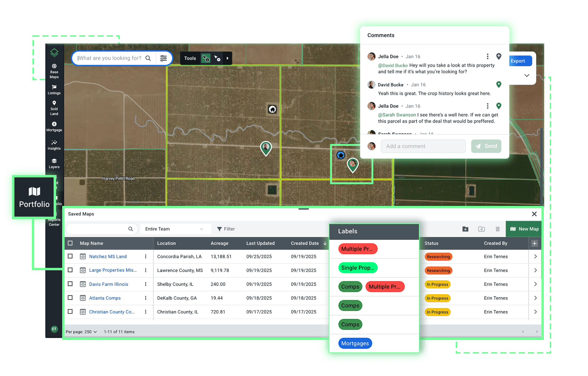
By contrast, a centralized portfolio built on Acres’ land research platform transforms governance from reactive to proactive. Instead of fragmented systems, everything is housed in one collaborative portfolio—maps, documents, parcel records—ensuring consistency across departments and making oversight manageable and transparent.
Say a transmission team is evaluating a potential substation location near a growing metro area. They need to confirm parcel ownership, proximity to high-voltage lines, and whether any easements or encumbrances might prevent development. Traditionally, this means cross-checking GIS maps, downloading shape files from a state utility site, and calling the local water district to verify infrastructure access.
With Acres, the team can pull up the parcel and immediately see ownership, transmission overlays, nearby substations, and even visualize easements or encumbrances—allowing the team to quickly screen out problematic sites with early due diligence and focus resources on viable options early on.
Acres’ Portfolio provides a single source of truth, combining parcel‑level data, environmental layers, infrastructure maps, ownership, transaction history, and document storage, all in one secure, shared workspace.
This unified record dramatically reduces the risk of errors or oversight, and teams can collaborate in real time with features for commenting, tagging, document management, and sharing maps.
With this level of transparency, utilities can make fast, confident decisions. Instead of gathering files from multiple departments or hunting through paper records, they can open the shared portfolio dashboard and instantly see a comprehensive, up-to-date view. This reduces regulatory exposure, streamlines compliance processes, and ensures that decisions are backed by complete and accurate data.
In an industry where oversight is high and mistakes are costly, utilities can’t afford fragmented data. By adopting Acres’ collaborative portfolio features, utilities can unify their land data, enable cross-team collaboration, accelerate audits, and significantly reduce regulatory and operational risk.
Ready to take control of your land data?
Book a demo to explore Acres Land Portfolio and see how a modern land portfolio can help your utility stay audit-ready, compliant, and operationally efficient.

Explore expert insights and benefits of timberland investment, including historical returns, income sources, and portfolio diversification.
Reveal hidden borrower assets and verify ownership in seconds. See how Acres' AI research helps lenders find undisclosed collateral and map full...
Through subsidiary Sidecat LLC, Meta has quietly assembled an 18-parcel portfolio in Licking County since 2017—paying over $1 million per acre in...
