GIS & Mapping
Map Highlight: U.S. Battery Storage Plants Map
Track battery storage plant locations nationwide and understand their impact on land value with Acres.com’s powerful mapping tools.
Visualize U.S. electric planning regions. See who manages power and how it impacts infrastructure, land use, and project siting for developers.

When it comes to new development, energy access is everything. Whether you're a developer scouting locations, an energy investor planning your next project, or a broker assessing property potential, understanding the electric system is critical.
That’s where the Electric Planning Areas Map on Acres.com comes in. It’s the map that connects your property goals to the power that fuels them.
An Electric Planning Area is a specific region where a utility company or electric provider oversees how electricity is delivered, expanded, and maintained. These areas are essential for keeping the power grid reliable as populations grow and energy needs change.
This nationwide layer outlines utility jurisdictions across the U.S. With this layer, you can gain a powerful lens into grid connectivity, future transmission opportunities, and regulatory boundaries that directly impact project feasibility and land value.
To explore this map and hundreds of other layers, connect with our sales team today!
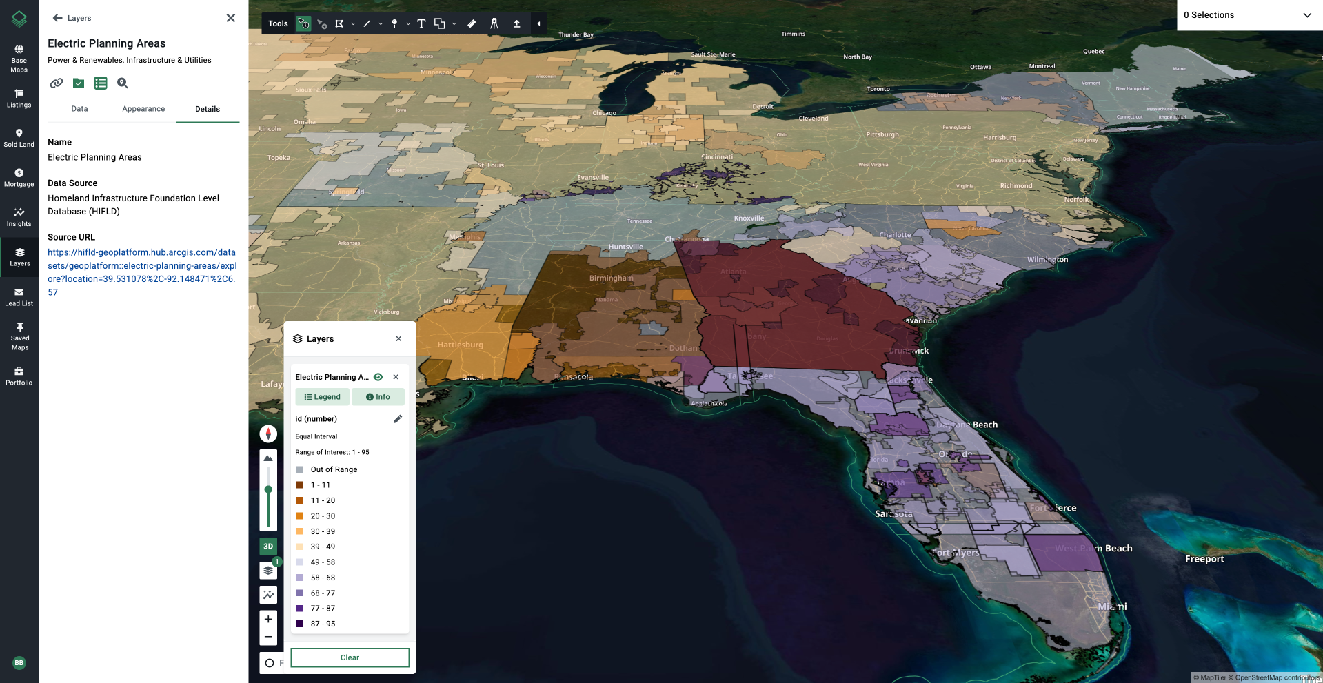
Acres’ nationwide power plant data is derived from the Homeland Infrastructure Foundation Level Database (HIFLD).
An electric planning area includes everything needed to deliver power — both what’s already built and what’s still on the drawing board for the future.
Inside a planning area, you’ll usually find:
But it’s not just about what’s already there. Planning areas are constantly looking ahead to decide:
Every electric planning area has an organization that's in charge of making sure there’s enough power now and into the future. These organizations are called planning authorities, and they can take a few different forms depending on where you live.
Here are the most common types:
Power access isn’t just a utility—it’s a strategic asset. The Electric Planning Areas Map on Acres gives you critical insight into how electricity flows, who’s in charge, and where infrastructure is headed.
Connect with our sales team today to get access.
Track battery storage plant locations nationwide and understand their impact on land value with Acres.com’s powerful mapping tools.
Explore U.S. ethanol plants with Acres’ map. Learn how these facilities can influence land values, crop prices, and development.
Explore power plants across the U.S. with Acres.com’s interactive Power Plants Map. Locate sites, assess land impact, and make informed real estate...
