GIS & Mapping
Map Highlight: Public Use Microdata Areas (PUMAs)
Discover how Public Use Microdata Areas (PUMA) provide key demographic insights for economic development, real estate, and urban planning.
See how Acres Intelligence uses AI rezoning analysis to surface municipal precedent, track future land use, and de-risk development opportunities in minutes.
-Sep-02-2026-04-24-46-6658-PM.png)
There's more to a strong land deal than its current zoning. Acquisition teams should have a way to see the signals that are harder to find: whether a rezoning is already in motion, whether neighbors are pushing back on new development, or whether a similar request was denied nearby and why. Accessing these answers can take weeks off an acquisition timeline.
That's the gap Acres’ AI rezoning analysis closes.
Current zoning tells you what's legally allowed today. It doesn't tell you what's likely to change, how a local council actually feels, or whether a neighborhood already sets a precedent that works in your favor. To get that picture, teams have had to piece it together by hand, one jurisdiction at a time.
Roughly 30,000 cities, counties, and other municipal authorities each run their own process, on their own schedule, with their own paperwork. Navigating this manually comes with several challenges:
That research can take days, and it has to be repeated for every neighborhood and every deal. Land teams traditionally put together the picture themselves: scanning agendas, digging through attachment pages on city websites, and hoping they did not miss key filings
"Rezoning analysis gives you a view of what city councils are doing on a map, so you have transparency in what decisions to expect or not expect from a city council in any neighborhood." — Aaron Shew, CTO, Acres
With a single prompt, Acres Intelligence’s AI rezoning analysis gives you the data to:
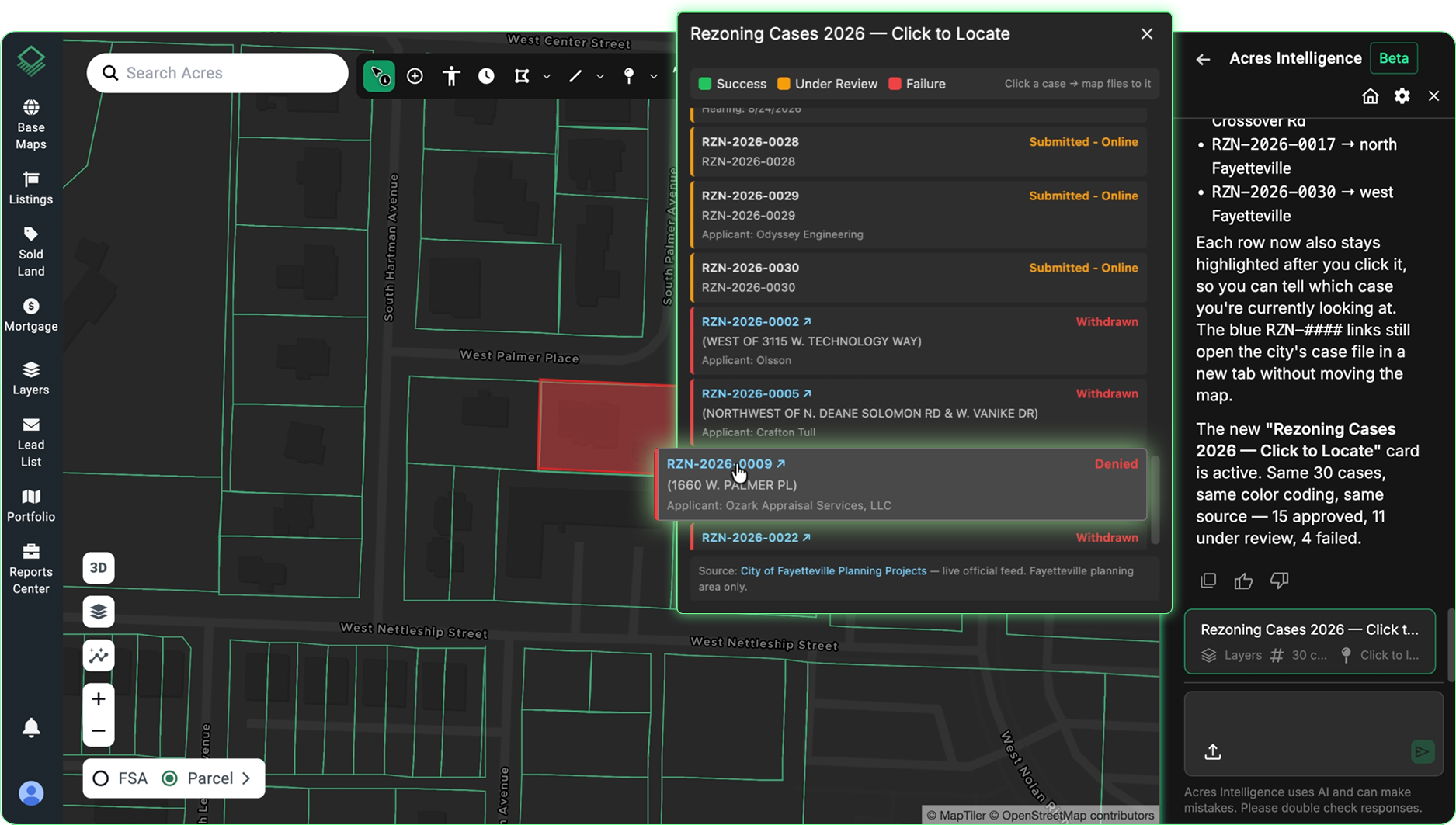
A parcel that gets rezoned from agricultural to residential can jump in value overnight, simply because it's now entitled to something it wasn't before. Knowing where that's likely to happen, and why, before it's public, is exactly the edge that lets your team move on strong sites with confidence and walk away from weak ones just as fast.
Access to instant rezoning analysis allows land teams to:
With current and predictive zoning data, your team can make better decisions with context that truly matters: this neighborhood, this council, this property, and the precedent already set nearby.
Acres Intelligence gives land teams both the speed to find changes as they happen, and the sources to trust what they find. Book a demo to see how AI rezoning analysis can de-risk your acquisitions and get your team the prime opportunities, first.

Discover how Public Use Microdata Areas (PUMA) provide key demographic insights for economic development, real estate, and urban planning.
Agricultural Economic Insights researchers, Randy Dickhut and David Widmar, use Acres' data to understand how debt is utilized when purchasing...
See how land brokers use Acres Pro to value land quickly, deliver defensible valuations, and win more land listings.